Spatial Analysis of Pakistan Population Census 2017
R
ppcSpatial
Pakistan Population Census 2017
The latest version of the ppcSpatial package for R is now on CRAN. It performs spatial analysis for exploration of Pakistan Population Census 2017 (http://www.pbscensus.gov.pk/). It uses data from R package PakPC2017.
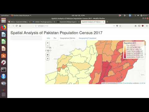
The Spatial map is
and full view is here.
A video showing some functionality of the package is
Citation
BibTeX citation:
@online{yaseen2018,
  author = {Yaseen, Muhammad},
  title = {Spatial {Analysis} of {Pakistan} {Population} {Census} 2017},
  date = {2018-05-13},
  url = {https://myaseen208.com/blog/2018-05-13_ppcSpatial/2018-05-13_ppcSpatial.html},
  langid = {en}
}
For attribution, please cite this work as:
Yaseen, Muhammad. 2018. “Spatial Analysis of Pakistan Population
Census 2017.” May 13, 2018. https://myaseen208.com/blog/2018-05-13_ppcSpatial/2018-05-13_ppcSpatial.html.